(IrinaK/Shutterstock)
Who Is Most Vulnerable to Inland Flooding?
- Title:
-
Fine-scale assessment of inequities in inland flood vulnerability
- Author:
-
Mathis L. Messager, Ailene K. Ettinger, Maia Murphy-Williams, Phillip S. Levin
- Source:
- Publication Date:
-
2021
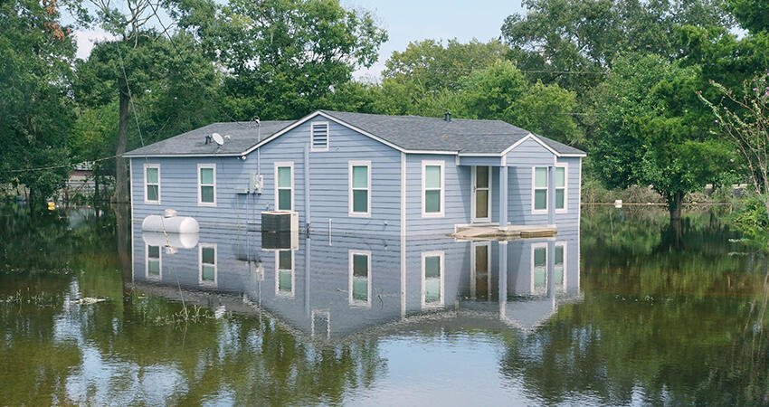
Inland flooding (from smaller bodies of water, like rivers) is a climate hazard that affects thousands of US residents annually. Inland floods pose substantial risk to communities and their environments; those affected incur monetary and psychological strain. Data suggest that flooding events are likely to increase in coming years. Yet, there has been little research as to whether there are inequalities in who is exposed to inland flooding. To address this concern, the authors of this study asked: Do households experience unequal vulnerability (exposure and capacity to adapt) to inland flooding based on their race and ethnicity?
Focusing on the state of Washington, the authors used a couple data sources to answer their research question: 2010 Census data at the census-tract level to get race/ethnicity and socioeconomic data and Washington State Parcel Database information at the parcel level to gather taxpayer names. They then used these data in a model that’s been used in several studies but that’s not heavily tested and is based on census data that combine racial and ethnic groups inconsistent with more recent framing. This model determines the probability of a landowner being in a particular racial/ethnic group based on their last name. For example, the last name “Smith” was found to be the last name of a non-Hispanic or Latino white individual 73 percent of the time.
For flooding data, the authors obtained floor maps from Fathom that used fluvial and pluvial flooding simulations to yield flood-prone zones. To determine disproportionate risk and vulnerability to inland flooding based on racial/ethnic group, the authors created an index of racial/ethnic representation in flood zones and used the socioeconomic status and demographic data to rank census tracts based on capacity to adapt, and these data contributed to an overall assessment for flood vulnerability. Overall, the authors found that Latino, Black, and Indigenous households in the Washington region were more vulnerable to inland flooding and its effects, and they asserted that maps with a more contextual, neighborhood outlook could better highlight acute inequalities.
Key findings
- Of all Washington residents, about 8.6 percent have at least a 1 percent chance of seeing their residence flooded any given year; this shows other data sources, such as the Federal Emergency Management Agency’s flood zone data, underestimate risk by 59 percent and 78 percent for the dasymetric parcel-level and filtered areal weighting block-level methods.
- In Washington, Latino residents are 8 percent of the population, yet 16 percent of those living in a flood zone are Latino. Asian, Black, and Pacific Islander residents were underexposed to floods, compared with white, multiracial, and Indigenous residents.
- Consistent with other literature, Latino residents were overexposed to inland flooding, compared with the general population and all other racial and ethnic groups in the study.
- Flooding vulnerability was higher in communities with larger proportions of Black and Latino residents. Specifically, in places with a Hispanic and Latino residents making up 75 percent of the population, the vulnerability was 86 percent higher. Where Black residents were at least 75 percent of the population, it was 66 percent.
Policy implications
- Local contexts are important factors in more accurately determining vulnerability to floods, including residential housing choices, access to mitigation measures, and perceptions of risk.
- Flood management plans should include vulnerability measures to better assess what mitigation is needed and for which households it should prioritize. For example, understanding who is in danger of flood risk and has a lower income can equip localities with who is most in need of assistive adaptive capacity.
- Technological investments in flood modeling can allow for more accurate data analysis and more acute vulnerability findings.


