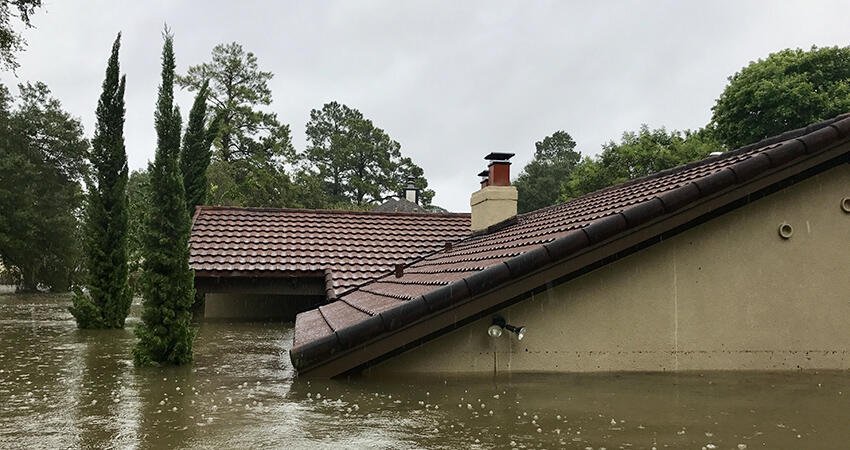
(MDay Photography/Shutterstock)
With Climate Change Poised to Worsen the Affordable Housing Crisis, Policymakers Need Better Data to Make Informed Choices
Nearly 20 million homeowners were cost burdened according to the most recent data. And today, mortgage affordability is historically low, supply lags far behind demand, and those with the lowest wealth and income cannot compete in the marketplace. Without policy changes, this affordable housing crisis will worsen, particularly in the face of increasing climate change.
As disasters become more frequent and severe and the costs associated with renovation, rehabilitation, and construction rise, insurers are paying out billions of dollars more in claims. Insuring climate disasters has become so expensive that home premiums have gone up, coverage has been reduced, and in some places, major companies are pulling out altogether. Housing finance regulators like the Federal Housing Finance Agency and policymakers focused on affordable housing are scrambling to understand how to ensure homeowners can obtain the coverage they need at a price they can afford, without incentivizing undue construction in high-risk areas.
But they can’t do that without a clear picture of which households and communities are most vulnerable to climate-related losses. And right now, decisions may be based on inaccurate information.
Who is most at risk? It depends on how you measure it.
State and local emergency preparedness and management most commonly use datasets from the Federal Emergency Management Agency (FEMA) to determine floodplain development rules and regulations, including which households are required to purchase flood insurance. But concerns about their accuracy have arisen as investigations uncovered entire communities unwarned of flood risk, research found the 100-year floodplain has been underestimated because of systemic omissions of pluvial flood risk, and FEMA’s data only consider historical flood events, not predicted changes.
In new research, we introduce a methodology that addresses some of these potential shortcomings, significantly altering findings about who faces the greatest risk. We focused on riverine flood risk because it is the most common flood type, and it’s been less studied because of limited data.
We believe our new methodology solves two major problems in FEMA’s National Risk Index.
FEMA’s expected annual loss (EAL) data excluded more than a quarter of census tracts, more than 43 percent of which were made up predominantly by low-to-moderate income (LMI) people of color. The FEMA data also underestimated risk, likely because the agency relies on historical events and the omission of flooding from smaller bodies of water and pluvial flood events.
To address this, we used a proprietary dataset from Verisk, which simulates potential future events through probabilistic analysis based on both historical and recent climate trends. Using these data allowed us to fill nearly 90 percent of the missing data from FEMA.
FEMA’s reliance on expected annual loss to measure the toll of a flood biases risk toward wealthier areas with more to lose financially. This doesn’t account for the decades of disinvestment, discrimination, and undervaluation that have led communities of color and LMI communities to have lower property values.
We improved the EAL metric for buildings by accounting for the total replacement value. We found a greater share of LMI neighborhoods (especially LMI neighborhoods of color) are at very high risk from riverine flooding using our approach than with EAL alone. By contrast, a lower percentage of higher-income neighborhoods are at risk using our revised metric (with a dramatic drop in higher-income neighborhoods of color). This is because even though building values may be lower in LMI neighborhoods of color, there may be more at risk in terms of total value, the cost of replacement as a percentage of the structures’ values may be higher.
To stay consistent with the FEMA methodology, we added in measures of social vulnerability and community resilience to formulate a composite risk metric. Research and lived experience have shown how differences in otherwise similar neighborhoods’ vulnerability, preparedness, adaptability, and capacity to recover lead to the same types of flood events decimating one community while only denting another.
Once we added in these metrics to our risk calculation, we found that LMI neighborhoods of color were the most likely to be at very high risk of riverine flooding, while higher-income neighborhoods with mostly white residents were the least likely to be rated very high risk—the opposite of the conclusions using FEMA’s original methodology. Given these findings, it’s clear: how we measure risk matters.
We’ve highlighted several significant issues with how FEMA measures risk, yet there is still a great deal of uncertainty we haven’t addressed. Disasters are becoming more frequent and more severe in ways models cannot fully predict and in ways that change the distribution of potential outcomes. Although probabilistic measures can provide greater precision and are superior to relying on only historical experience, these models may be subject to large revisions over time.
Despite this lack of information, policymakers will be faced with a continuing trade-off between environmental and social goals. Failure to meet environmental goals has consequences, but failure to improve the affordable housing landscape will disproportionately affect less wealthy households and, because of structural racism, households of color.
To subsidize or not to subsidize
The insurance industry is a clear example of how the tensions we’ve highlighted between social and environmental goals manifest in the marketplace.
For example, let’s explore a long-simmering debate: How should insurance for climate disaster be priced and delivered?
On one hand, economic theory suggests that if households could understand their risks via insurance costs that make their true risk economically salient, they would make decisions that better reflect that risk (PDF). For example, pricing individual insurance for fully estimated risk may help move us toward resilience or discourage people from moving to high-risk areas.
On the other hand, given our findings that some risks, like riverine flooding, are concentrated in more-vulnerable communities, forcing everyone to pay premiums that fully reflect the estimated risk could place significant financial strain on those least able to bear it, exacerbate existing affordability issues, and even put homeownership out of reach from those historically shut out from building wealth. Policymakers may want to consider subsidizing this insurance for some borrowers.
Borrowers need more information on the risks to the property and their insurance options
Balancing access to affordable housing and rising insurance costs with environmental and social goals is challenging. A clear picture of household risk that includes economic and noneconomic factors, like what we’ve proposed, is critical to developing effective solutions.
Policymakers, regulators, and researchers can consider the following steps to improve transparency about risk and improve outcomes for consumers:
FEMA can enhance its data. This will help ensure the most vulnerable households and communities are not incorrectly uncovered. It will also help city planners and emergency management leaders make informed choices that prioritize resident safety and sustainability.
Although FEMA has begun to take some steps to improve its flood risk calculations, such as by considering some property specific risks, it has yet to incorporate future-looking data. FEMA could incorporate predictive data to improve its and the public’s understanding of risk. While developing its own methodology, FEMA could contract with private entities that already have these data in the interim to expedite information dissemination.
- The Consumer Financial Protection Bureau could improve homebuyers’ understanding of risk and insurance needs by developing and requiring disclosures related to home sales and mortgages. Not all homeowners understand, for example, that their homeowner’s policy doesn’t cover flooding—those in high-risk areas need special floor coverage. This could help ensure vulnerable consumers don’t move to high-risk areas without full knowledge.
- Regulators could provide meaningful upfront information to consumers on insurance coverage. Given all the emerging risks, many consumers don’t understand what they’re covered for or how much is covered between their homeowner’s insurance, flood insurance, and other types of coverage. Regulators, including the National Association of Insurance Commissioners and the Federal Insurance Office, should require insurers, before each policy renewal, to transparently detail what is and is not covered in terms clear to the average consumer.
Improving data and consumer information and understanding are just the first steps. As the frequency and severity of disasters increase, there is more to do to understand other types of climate disasters. The public and private sector ultimately will need to work together to offer consumers insurance policies that address their needs, at a cost they can afford, while discouraging construction in the riskiest areas.


